In three decades, the United States will have a “majority-minority” population. We asked four artists to consider this demographic shift. Here is Oyama Enrico Isamu Letter, an abstract artist and painter who draws on the visual elements of graffiti culture.
April 17, 2013
It is projected that within three decades, the United States will have a “majority-minority” population. We asked four artists to consider this demographic shift, and show us their visions of the year 2050. Here is Oyama Enrico Isamu Letter, an abstract artist and painter who draws on the visual elements of graffiti culture.
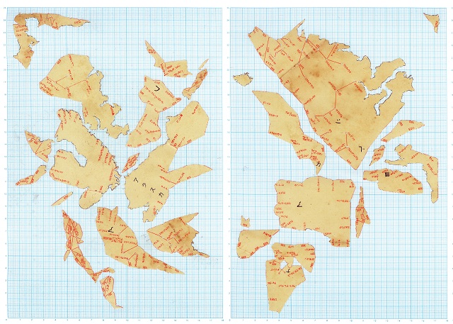
While visiting a second-hand antique maps store in the Jinb?ch? neighborhood of Tokyo, which is known for its used bookstores, I came upon a map made in Japan in 1937 that charted international air routes right before World War II. The web of airline networks had been printed over a map of the world, and seemed to suggest a new visual method of dividing land masses and bodies of water. Rather than emphasizing national boundaries, this map traced people’s movements across the planet.
In 30 years, racial and ethnic minorities in the United States will together comprise a majority of the population. What if, through such cultural and geopolitical shifts, the national boundaries and artificial geographies that arose in large part out of colonial interests were called into question? To visually interpret what a majority-minority in the United States might mean globally, I wanted to create a new world map from the one I had found, a new configuration of lands.
Taking the map, I cut it into small pieces along the complicated network of airline routes and arranged the pieces on graph paper, which became an ocean with a geometric grid. The new shape of the world that I formed is a geopolitical inversion of sorts: what was once a world of geometric land masses, defined by the lines of national boundaries and surrounded by variable oceans, transformed into one of variable lands with geometric oceans, where boundaries are determined by people’s movements.
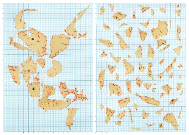
The World Atlas 2050 #1, #2, #3, #4
268mm(h) x 190mm(w) (each)
Paper Collage on Graph Paper
2012
What does 2050 look like to other artists? To view the rest of the pieces from this series, click here: